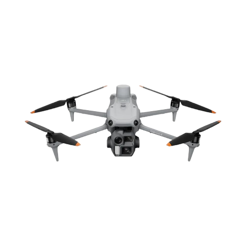
DJI Matrice 4 Enterprise

Experience precision-driven aerial mapping with the DJI Matrice 4E — a compact, intelligent flagship drone built for geospatial workflows. Equipped with enhanced sensing, AI-powered flight safety, and high-accuracy measurement capabilities, the Matrice 4E delivers efficient, reliable performance for surveying, mapping, construction, and mining operations.

  • Wide-Angle Camera: 4/3 CMOS, 20 MP effective pixels, f/2.8–f/11, 24 mm equivalent, mechanical shutter
  • Medium Tele Camera: 1/1.3" CMOS, 48 MP effective pixels, f/2.8, 70 mm equivalent
  • Tele Camera: 1/1.5" CMOS, 48 MP effective pixels, f/2.8, 168 mm equivalent
  • Laser Range Finder: Measurement range up to 1,800 m (1 Hz), 600 m oblique incidence (1:5 ratio), 1 m blind zone
  • Range Accuracy: ± (0.2 + 0.0015 × D) m

Download Datasheet

DJI Matrice 4 Enterprise

Related Product

Light Weight & Long-range LiDAR

Detail

High-Precision Mapping LiDAR

Detail

Fully Powered to Forge Ahead

Detail
Marketing Sonar
Sonar Nusantara Indonesia
Halo
Ada yang bisa kami bantu ?
Start Whatsapp Chat